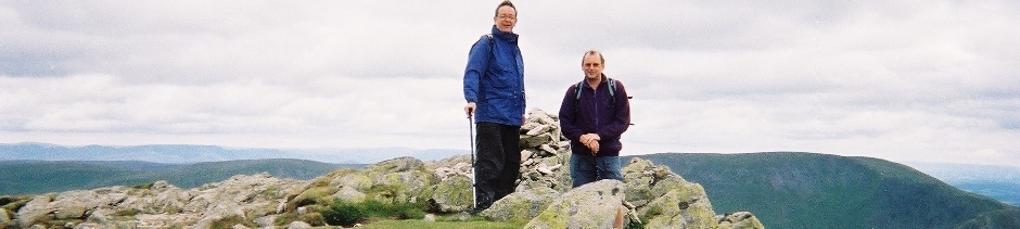
On leaving the hotel there
starts quite a long hard climb up to Boredale Hause. Slightly difficult
navigation here to get the right path up towards Angle Tarn. Angle Tarn
towards The Knott is quite straightforward with an almost level good
path. The Knott is a pointed hill which is quite a climb but nothing
too difficult. Then follows a quite wide track on The High Street and
a very sharp left turn onto a gentle climb up to Kidsty Pike which is
the highest point of the whole walk. From Kidsty Pike down to Kidsty
Howes there is a reasonably gently descending grassy path. Kidsty Howes
itself is an outcrop of rock with a very steep descent down towards
Haweswater (steep for about 400 yards but very stony and quite difficult
– it would be very difficult to come up it). Really damaging to
the knees and continues to be very steep although better underfoot all
the way down to Haweswater Reservoir at Bowderthwaite Bridge. Any hope
of an easier time at this point is destroyed on realising that there
is quite a steep and rocky path to get round Gate Crag – immediately
the water line is reached on the descent from Kidsty Howes have to start
climbing up again. In fact the 3½ walk along the lake is not
too easy. Pass The Forces, a not too impressive waterfall, to the lakes
end at Burnbanks and then a pleasant walk alongside Haweswater Beck
through Rawhead and to Rosgill which is the northernmost point on the
walk. Follow close to the River Lowther to Shap Abbey and then to Shap.
A hard day’s walk.
Accommodation
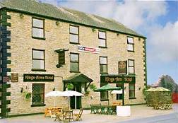
I am booked into the King's Arms Hotel, Shap. Single ensuite £45 b&b
Click image for details or for other accommodation follow the Sherpa Van link
Signed up for this day: David Brawn, Keith Case, Nigel Williams, Nick Case, Tom Case
Some notes on the day
When we got up it was raining, had been raining heavily in the night and the forecast was for thunderstorms. All the local hills were covered in cloud. So we decided on local advice to take the steamer from Glenridding to Pooley Bridge. This is the length of Ullswater and on getting to Pooley Bridge with our American friends we set off across Askham Fell. After the fell we used country lanes to Bampton where we had lunch in the Mardale Inn – very good beer. Continued through Bampton Grange, Rosgill and then across several fields to get to Shap. Continued down the main street of the long village to the King’s Arms at the southern end of the village. In the evening we got a taxi to go back to the Mardale Inn at Bampton in the hope of better food and beer (it was). Taxi cost £40 because as there were 5 of us he had to make the journey twice in each direction.
Accomodation
and baggage transport |
 |